We make the operation of local governments easier! We support the planning, modification and implementation processes. In addition to the registration of the settlement properties, the easy-to-use, user-friendly ForteMap GIS system also provides an opportunity to monitor the assignment of tasks and the status of work processes.
We recommend it for…

Local governments

Government agencies

Utility operators

Road managers

Basic GIS functions
A basic surveying basic map, various settlement structure and regulation plans, orthophotos, utility maps can be integrated into the system.
Manage, add, edit and modify map elements - point, line, polygon - and related data, objects.
The system is able to manage real estate records, search for addresses and topographical numbers and show their location.
It is possible to print map layers and objects to scale.
The system allows the creation of a thematic map (eg. coloring of districts based on population, supply or other data).
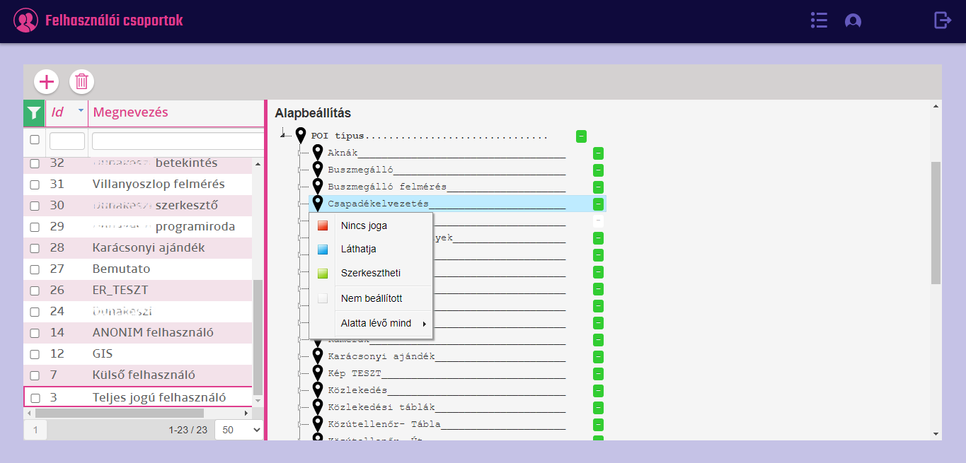
The system is configurable, user groups can be created with different privileges.
You can view, filter, and export map items in both map and list views.
A basic surveying basic map, various settlement structure and regulation plans, orthophotos, utility maps can be integrated into the system.
Manage, add, edit and modify map elements - point, line, polygon - and related data, objects.
The system is able to manage real estate records, search for addresses and topographical numbers and show their location.
It is possible to print map layers and objects to scale.
The system allows the creation of a thematic map (eg. coloring of districts based on population, supply or other data).
The system is configurable, user groups can be created with different privileges.
You can view, filter, and export map items in both map and list views.

Measurement in the picture
It is used to display images taken during the survey

It is used to display and analyze point clouds from images taken during the survey
Measurements and analyses can be done more easily from the office or home. The geographical coordinates of any point that can be determined in the point cloud. Distances, areas, angles, and volumes can also be measured.
A cross-section can be made, thus analyzes can be performed, a flood map can be created.
Contoured, height-colored coloring helps the job.
The point cloud can be traversed along the surveyed and processed trail in sync with the photos taken.

Thanks to the artificial intelligence we have developed, time-consuming, complex field surveys are a thing of the past! Artificial intelligence recognizes various objects by type, such as traffic signs, hydrants, drains, or potholes and inserts them on surveyed road sections, with high accuracy.
The Artificial Intelligence detects and frames objects on images by the type.
Objects recognised during detection are inserted on the map, creating so-called POIs (Point of Interest). This shows the exact position of the objects on the map.
You can check the correctness of objects inserted on the map and modification is also possible, if needed.
Artificial intelligence can be further taught. In this way, after applying the sample data, so-called learner data can be created.
The ever-changing traffic order and its signs can be easily tracked and planned. Thanks to the survey and the inserted objects up-to date data are available for the staff of the Municipality.
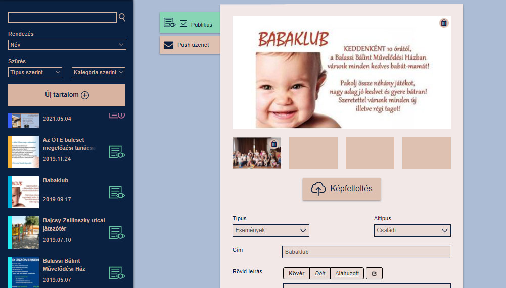
Content editor module
For creating, editing and sending push messages in the Smart City application.
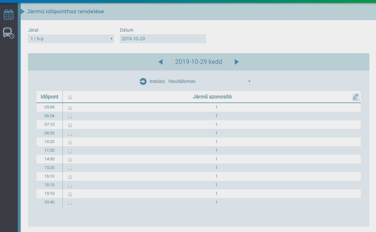
Schedule editor module
As an optional module in the Smart City application it can be used to edit and manage the bus schedule.
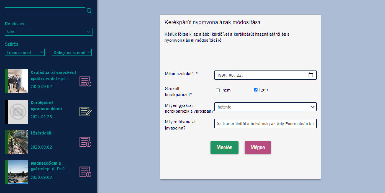
Questionnaire module
It is used to create and edit the questionnaires appearing in the Smart City application and to view and analyze the answers given by the users.
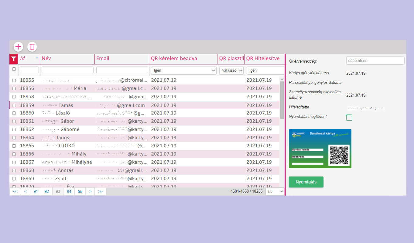
City discount card module
It is used to authenticate the virtual city card used in the Smart City application, as well as to create, edit discounts and manage card readings.
Events module
Used to create event's entry gates and control, edit entries.